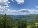
Post your recent hiking pics

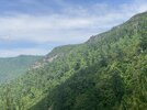
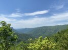
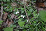
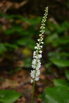
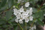
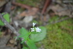
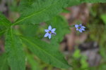
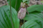
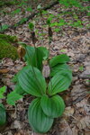
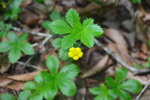
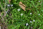
Been trying to get to this spot to check on the Lady's Slippers. Well, we were a week or two too late. Only one still had a flower on it and it was almost done. And the prescribed burns they did a while back were right up along the ridge for the two trails down to Wilson's Creek. So everything but the woods down by the creek was burned over. Well, at least we got outside and I caught a couple fish too. And I found out my DSLR still works. And it's much better than the phone for the flower pics.


DSC_0052.JPGDSC_0054.JPGDSC_0058.JPGDSC_0059.JPGDSC_0061.JPGDSC_0063.JPGDSC_0066.JPGDSC_0068.JPGDSC_0065.JPGDSC_0071.JPG
 
Took “Foxtrot” (my daughter) and hiked just under 11.7 miles in Linville Gorge today. Shortoff Trail from the Wolf Pit parking area, MST to a point just shy of Table Rock ridge on the ascent up from Chimney Gap, then back to Wolf Pit. Took a shortcut on the way back down the Jeep Trail, as we were running out of time.

We hit the trail an hourish later than planned and it was already getting warm. Sweat was the name of the game and we did a lot of it. Very humid and hazy, so views were not as nice as usual. Still, lots of blooms and LOTS of USAF jets shooting the Gorge today. Most I’ve ever seen/heard. Other than a break around lunchtime, they were flying through the Gorge almost the whole time we were there.

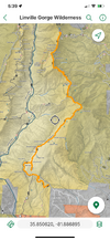
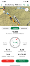
Someone (USFS? Friends of the MST?) cut new switchbacks in the STEEP part of the MST going up from Saddle Camp to Table Rock ridge. The old trail was, well, straight up and had eroded into a chute that was 4’ deep in places and ROUGH! The new trail is much easier to hike. Still plenty challenging but I didn’t have to stop a dozen times on the way up to catch my breath like always happened with the new trail. . They filled the old chute with brush they cleared from the new trail. LOTS of nice views from the new trail, too. The switchbacks add about .25-.3 mile to the distance shown on this section from Avenza.

By about mile 8, my butt started to get kicked. I took in 10 liters of water, 6 of which were water bottles in my pack to add training weight. It wasn’t enough, but I didn’t want to filter on the return trip due to our time crunch, so I toughed it out. Foxtrot had a 100 ounce water bladder and never ran out.

All in all, a good, but humbling day. I was hoping to do better on endurance. We are training for a 70 mile backpacking trip later in summer and I’ll have to do more than 12 miles per day most days on that trip. Sigh. Just have to keep chugging along.
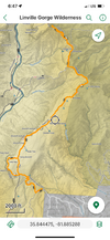
IMG_3315.png

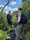
My view of Foxtrot most of the day. Her in front and me trying to keep up.
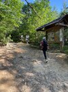
IMG_3282.jpeg

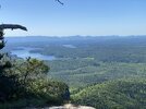
Obligatory shot of Lake James from Unbelievable Point. I always send this shot to my wife so she knows we are alive and on trail.
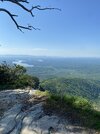
IMG_3284.jpeg


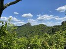
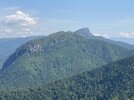
Table Rock from Shortoff Mountain. Never get tired of this view.

IMG_3289.jpeg

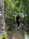
Foxtrot heading up the new switchbacks and some views from said switchbacks.
IMG_3300.jpeg

IMG_3301.jpeg

IMG_3303.jpeg

IMG_3304.jpeg

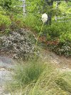
Beargrass/turkeybeard where we turned around on the MST.

IMG_3307.jpeg

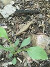
On the way back down Chimey Gap, this large fence lizard jumped off the trail. His tail is growing back from saving his life from some predator at some point.
IMG_3313.jpeg

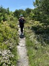
Typical view of Foxtrot as we trudged back across Shortoff. She got harder to keep up with as the day wore on, except on the downhills. She sprained her ankle in January and is still very cautious with it on rough terrain, especially downhills.
IMG_3314.jpeg

Closeup showing the new switchbacks on the “now-old” Avenza map.


IMG_3305.png
 
Last edited:
I live near the Gorge and hear the jets at several intervals today. I was working in the yard and mowing and never seen them once I heard the noise, except for the last one this afternoon-he was HIGH too. Way higher than some I see heading to the Gorge or leaving it normally. F22 or F35 I *think*...
 
Another visit to Linville Gorge yesterday. Had my two youngest with me - Hotel Mike (one of the dynamic duo, The Hiking Machines) and Foxtrot (a hiking machine in her own right).

Hiked Wolf Pit parking area to Table Rock parking area and back. Total distance around 14 miles. It was 7.3 miles out, and about 6.8 miles back, as we took a shortcut trail the last leg of the return. For this time of year, the weather was about perfect. Sunny to partly cloudy, high temps in the 70s with a breeze most of the day. Wind gusts on the mountain tops up to 20-30 mph - enough to take your hat off if you weren’t careful, but felt good in the heat of the hike.

There were a lot of people on the trail for a Wednesday. Many of them on overnight or multi-day trips. From their load outs, you could tell a lot of them were novices. Good on them. We were able to help three groups with trail intel on water sources. Water is the trickiest part of this part of the Gorge and a lot of them obviously assumed it would just be there when they needed it. One young couple had German accents. They were one night into a three to four day loop and were running dry. I had a couple extra water bottles I shared and then showed them on their map where the nearest water source was. Nice folks.

Fighter jets flew through the Gorge several times, but not as many as last week’s hike.

I moved up to my full sized pack and upped my pack weight, as we are training for a long backpacking trip later in the summer. I made it through, but was pretty tired last night. Wound up in bed before 8 PM. This section of trail is excellent training due to the two big ascents on it, plus several smaller ones.

IMG_3376.png
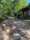
This was as close as I got to them much of the day, and this is at the trailhead lol

IMG_3361.jpeg

Lake James from Unbelievable Point

IMG_3366.jpeg

Moon over Rockpeak, the highest point on Shortoff Mountain

IMG_3369.jpeg

I caught up with them because they were checking out a view.

IMG_3370.jpeg

Table Rock. We are headed that way.

IMG_3371.jpeg


Looking down the Gorge from a newly rerouted part of the Mountains to Sea Trail

IMG_3374.jpeg
 
Last edited:
Back
Top Bottom