Wildflowers, waterfalls, and trout.

chiefjason

Vendor and Leather Hack
2A Bourbon Hound 2024
2A Bourbon Hound OG
Vendor
Joined
Dec 18, 2016
Messages
10,773
Location
Longview, NC
Rating - 100%
12   0   0
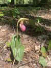
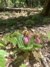
Been heading up to South Mtns State Park for some hiking the last 2 weeks. Wildflowers and trout are starting to wake up. Did a 4.8 mile loop today.

9c57987fd1956b08f46195837a64708c.jpg

dd23fb6684ffab80685bb7250ffd8ce4.jpg

c27785b5ffd2865bb411ea8fb2c797a7.jpg

c98d4f9d4aa4bbea3848b737c773429f.jpg

44b539c7795f88c044a4a0e49cdc452c.jpg

f8c859cdf978c5a32909472d993a9929.jpg

f4350c0b6c9d9e8c41b6711f35166715.jpg

8f4d8e3c9726072600c4a3177b46f96a.jpg

53af3c0133323df07d62e0376f93a09c.jpg


Sent from my iPhone using Tapatalk
 
Beautiful. I miss the mountains in the spring
Nice pictures. I noticed some blood root, trillium, and foam flowers. It has been 45 years since I knew the rest.
 
Blood root and trillium are a couple of my all time favorites.

I did something similar closer to home last weekend but never took a photo. It was an escape for my soul.

Spring in the mountains is a beautiful thing!!!
 
The Wake Robin Trilliums at South Mtns are pretty amazing when they all start to bloom. Still waiting on the Lady's Slippers to pop.
 
I’ve got pink lady slippers that bloom at a little spot 100 yards from my front door. Not my land and undeveloped. I visit every spring, 15 years straight.
 
I haven’t fished up there in years! It got bad for poaching and they cleaned the stream out. I might have to spend a day going up there soon.
 
Beautiful photos... Thank you. What app or gps are you using to track your route?

Apple watch and the Fitness app on my iphone. And when I pull up the route I switch it to satellite view. I also use Avenza maps when I can find a digital map of where I'm hiking. Avenza is a great app. Currently using it to plan a backpacking trip.
Are the orange spots on the map where you took a dump?

JK....great photos, and per @DurhamDad post, what are you using to track your route?

I'm not sure but I think the orange is uphill and the green is downhill.

I haven’t fished up there in years! It got bad for poaching and they cleaned the stream out. I might have to spend a day going up there soon.

I was up above the falls. The DH part still has some fish but nothing like it used to have.
 
Thanks, I have used Avenza a bit and like it as well but have struggled to get good aerial or satellite maps into the areas I need them.

I am trying Gaia GPS now and like the Avenza interface a bit better. I am also a bit disappointed in Gaia's accuracy for recording a track. I guess that could just be a limitation of my phone GPS though.

The only place I’ve had Avenza loose signal was on Lost Cove creek down from the cliffs. Mine even tracked in Linville Gorge and deep into the Smokies.

The gap in the pic above was my watch acting up and not wanting to start after pausing it.


Sent from my iPhone using Tapatalk
 
Apple watch and the Fitness app on my iphone. And when I pull up the route I switch it to satellite view. I also use Avenza maps when I can find a digital map of where I'm hiking. Avenza is a great app. Currently using it to plan a backpacking trip.


I'm not sure but I think the orange is uphill and the green is downhill.


I was up above the falls. The DH part still has some fish but nothing like it used to have.
They used to load up the DH waters but the the campers would poach them after they left and locked the gates.
 
Used to fish the lower part with my pop every opening day....

Are the no swimming signs new? We swam at the bottom of the falls and lounged in the pools at the top of the falls for years.
 
Used to fish the lower part with my pop every opening day....

Are the no swimming signs new? We swam at the bottom of the falls and lounged in the pools at the top of the falls for years.

They probably got tired of hauling out the dead and injured. Usually a couple a year or two still. We used to jump in at the bottom and fish up to the falls. It's a neat little rock maze to work through.
 
Back
Top Bottom