You are using an out of date browser. It may not display this or other websites correctly.
You should upgrade or use an alternative browser.
You should upgrade or use an alternative browser.
Post your recent hiking pics
- Thread starter chiefjason
- Start date
- Replies 542
- Views 13,299
cubrock
Swell guy
2A Bourbon Hound 2024
2A Bourbon Hound OG
Charter Life Member
Benefactor
Multi-Factor Enabled
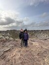
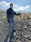
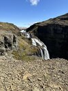
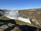
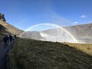
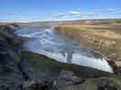
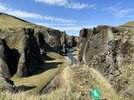
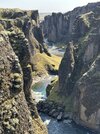
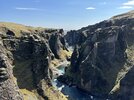
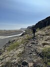
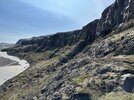
Glymur falls hike in Iceland
View attachment 623518View attachment 623519
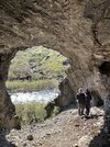
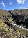
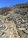
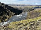
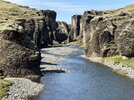
Several climbs to the top of the falls. There were a couple of climbs after reaching the top seen in the first of these next photos.View attachment 623520View attachment 623521View attachment 623522
Top of the falls. Best views are from the other side of the river, but the cables across the river aren't open until next month.
View attachment 623524
What was the temperature like?
Much better weather yesterday! We had snow on the mountain tops and high winds overnight, but then it was high 40s and sunny during the day. Windy and cold in open areas but we were wearing t-shirts for much of the descent. Today is cold and rainy again. I was totally unprepared for the rain/wind combination. 0.1" rain/hour didn't sound too bad, but with 20mph winds you really need rainproof boots, pants, jacket, and gloves or it gets miserable very fast.What was the temperature like?
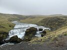
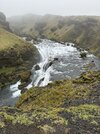
Another rainy day but we had a fantastic hike at Skogafoss. Half a dozen large waterfalls and tens of smaller waterfalls. The weather seemed to be improving at the start of the hike so I didn't wear contacts and rain gear -- big mistake. Visibility wasn't great and we got soaked, but still a great hike! Warmed up with a change into dry clothes followed by soup and coffee after the hike.
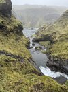
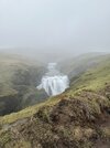
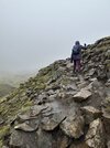
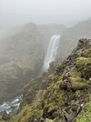
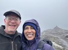
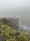
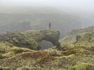

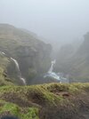
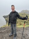
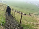
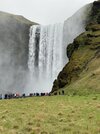


Roads were closed in the morning yesterday due to high winds, and our zodiac tour of the glacier lagoon was canned. So we hiked a bit around the lagoon.
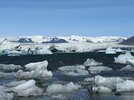
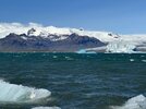
After that we did a nice hike out to the edge of one of the glaciers. A little over 1000 ft of climbing.
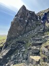
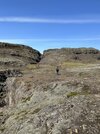
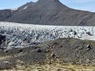
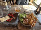
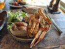
Finished the day with a nice meal! (We were early birds but the place filled up quickly.)
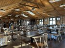



After that we did a nice hike out to the edge of one of the glaciers. A little over 1000 ft of climbing.


Finished the day with a nice meal! (We were early birds but the place filled up quickly.)


Iceland is awesome. Hope to see it sometime myself.
There’s now a direct flight from RDU… it is absolutely beautiful with so many different landscapes and terrains.. some very easy yet beautiful short hikes along with as many complex hikes as you’d like..the only thing that sucks about Iceland, is the price of food.. take ramen w you😂Iceland is awesome. Hope to see it sometime myself.
Last edited:
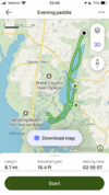
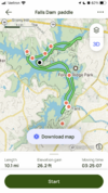
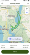
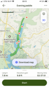
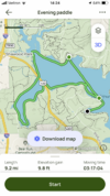
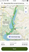
Since May 4th I made it out paddling nine additional times, all on Falls Lake and many to the Beaverdam Rec area in the evening. That area is non-motorized craft only and with the volume of people & boats on the water dramatically increased since the warm weather arrived; I'll leave the main lake mostly to the power boaters until Labor Day.
Side note: if you've ever heard of or experienced the "People of Walmart" effect just go to a boat ramp on a weekend in the Summer for some true quality entertainment!!
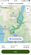
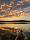
My favorite monthly paddle is a Sunset to paddling under a waxing gibbous which I got to do Wednesday and Friday this past week. There is just something to paddling on a body of water under a nearly full moon that really Zen and resonates with me.
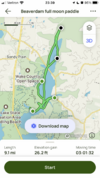
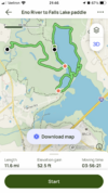
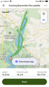
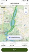
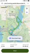
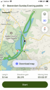
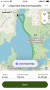
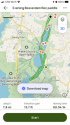
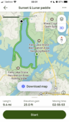
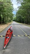
Adding all those trips up yields ~88 miles. A LOT of wildlife including osprey, bald eagles and beavers, but zero otters. Also, I took lots of pictures as well, but the very short list of best three are:
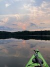
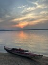
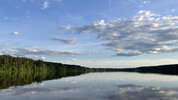
Side note: if you've ever heard of or experienced the "People of Walmart" effect just go to a boat ramp on a weekend in the Summer for some true quality entertainment!!
My favorite monthly paddle is a Sunset to paddling under a waxing gibbous which I got to do Wednesday and Friday this past week. There is just something to paddling on a body of water under a nearly full moon that really Zen and resonates with me.


Adding all those trips up yields ~88 miles. A LOT of wildlife including osprey, bald eagles and beavers, but zero otters.


cubrock
Swell guy
2A Bourbon Hound 2024
2A Bourbon Hound OG
Charter Life Member
Benefactor
Multi-Factor Enabled
Been a while since posting a trail report, mainly due to us hiking the same couple trails over and over for training.
Today, we decided to add some variety and hike Grandfather Mountain. Plan was to start at the Holloway Mountain Rd parking area and take the Tanawha Trail west to the Daniel Boone Scout Trail and up to Calloway Peak, then back. Round trip would have been about 14 miles.
From Holloway Mountain Rd, it is about 4 and a skosh miles to the head of Boy Scout. These miles are rolling hills through pasture and woods. We had to move cows out of the way for one fence crossing. Couldn’t get pics because we started the hike with ponchos on and it was too much work to get to the camera while trying to gently scare cows away. There are some decent descents and ascents on this section, but none are as hard or as long as on the mountain proper. Not even close.
It threatened to rain off and on through the day, but it did little more than sprinkle a couple times. We stopped for first lunch 4 miles in and took our ponchos off. That is when the wind hit us and it got cold. Warmed back up as long as we were moving, but it was obvious hypothermia was a threat, especially as we went higher up the mountain. Temps were in the 50s or low 60s, but we were soaked with sweat from being in the ponchos and wind chill made it uncomfortable. I noticed my hands got cold to the touch a few minutes in on any stop we made.
We made it halfway (1.5 miles) up Calloway Peak and I decided it was time to turn around. It was going to be even colder at the top and there were ladders and cables to negotiate in the last half mile - ladders and cables that would be wet. Add in cold hands and potentially a thunderstorm and discretion was the better part of valor.
We took the Scout trail down to the Cragway Trail and took it to the Nuwati Trail, which got us back on Tanawha. There are some great views on the Cragway Trail, looking across and over Boone Fork Bowl. We could look up from there and see the top part of Calloway Peak hidden in clouds.
Total hike was just a bit above 11 miles, though Avenza stopped tracking the last bit and shows only 10.48. I’ve had Avenza do this on this stretch of trail before.
We may try to do the full 14 next week. Depends on the weather.
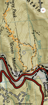
Avenza has no complete base map for this trail, just the Grandfather Quadrangle USGS topo. Almost half the hike was off map.
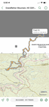
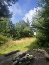
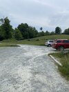
View from the parking area. Blackberries are blooming.
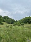
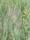
Neat grass at the parking area. Has a purple hue.
Trail goes through the gate and across the pasture. There are cows in the pasture, though you don’t always run into them. We did today.
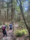
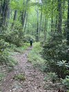
My view of my daughter sometimes, when she let me catch up. She is fast!
Views from Cragway. First pic is Calloway Peak, where we intended to wind up, in the clouds.
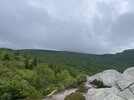
Looking across Boone Fork Bowl.
Towards Price Lake.
Today, we decided to add some variety and hike Grandfather Mountain. Plan was to start at the Holloway Mountain Rd parking area and take the Tanawha Trail west to the Daniel Boone Scout Trail and up to Calloway Peak, then back. Round trip would have been about 14 miles.
From Holloway Mountain Rd, it is about 4 and a skosh miles to the head of Boy Scout. These miles are rolling hills through pasture and woods. We had to move cows out of the way for one fence crossing. Couldn’t get pics because we started the hike with ponchos on and it was too much work to get to the camera while trying to gently scare cows away. There are some decent descents and ascents on this section, but none are as hard or as long as on the mountain proper. Not even close.
It threatened to rain off and on through the day, but it did little more than sprinkle a couple times. We stopped for first lunch 4 miles in and took our ponchos off. That is when the wind hit us and it got cold. Warmed back up as long as we were moving, but it was obvious hypothermia was a threat, especially as we went higher up the mountain. Temps were in the 50s or low 60s, but we were soaked with sweat from being in the ponchos and wind chill made it uncomfortable. I noticed my hands got cold to the touch a few minutes in on any stop we made.
We made it halfway (1.5 miles) up Calloway Peak and I decided it was time to turn around. It was going to be even colder at the top and there were ladders and cables to negotiate in the last half mile - ladders and cables that would be wet. Add in cold hands and potentially a thunderstorm and discretion was the better part of valor.
We took the Scout trail down to the Cragway Trail and took it to the Nuwati Trail, which got us back on Tanawha. There are some great views on the Cragway Trail, looking across and over Boone Fork Bowl. We could look up from there and see the top part of Calloway Peak hidden in clouds.
Total hike was just a bit above 11 miles, though Avenza stopped tracking the last bit and shows only 10.48. I’ve had Avenza do this on this stretch of trail before.
We may try to do the full 14 next week. Depends on the weather.
Avenza has no complete base map for this trail, just the Grandfather Quadrangle USGS topo. Almost half the hike was off map.

View from the parking area. Blackberries are blooming.

Neat grass at the parking area. Has a purple hue.

Trail goes through the gate and across the pasture. There are cows in the pasture, though you don’t always run into them. We did today.

My view of my daughter sometimes, when she let me catch up. She is fast!

Views from Cragway. First pic is Calloway Peak, where we intended to wind up, in the clouds.

Looking across Boone Fork Bowl.

Towards Price Lake.

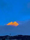
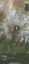
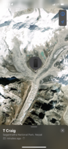
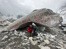
WTF! That sounds amazing! I'd like to hear more about this.wife did Everest base camp last month
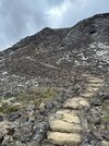
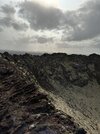
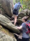
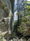
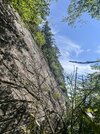
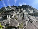
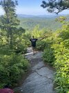
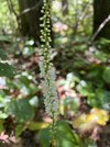
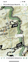
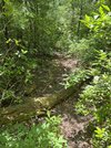
About 3 miles hiking Hawksbill Ledge “Trail”. In parenthesis because it’s a un maintained Gorge rat trail around the mountain. We hiked down the road and then climbed Hawksbill. Trail started off as an overgrown trail. Got pretty sparse in places and hard to follow. Made it to the ledge and got turned around a couple times. Finally just followed the ledge around and it turned onto a steep rock scramble / goat trail. It was a butt kicker of a trail. We were all worn out by the time we got out.



Last edited:
cubrock
Swell guy
2A Bourbon Hound 2024
2A Bourbon Hound OG
Charter Life Member
Benefactor
Multi-Factor Enabled
About 3 miles hiking Hawksbill Ledge “Trail”. In parenthesis because it’s a un maintained Gorge rat trail around the mountain. We hiked down the road and then climbed Hawksbill. Trail started off as an overgrown trail. Got pretty sparse in places and hard to follow. Made it to the ledge and got turned around a couple times. Finally just followed the ledge around and it turned onto a steep rock scramble / goat trail. It was a butt kicker of a trail. We were all worn out by the time we got out.
View attachment 631015View attachment 631016View attachment 631017View attachment 631018View attachment 631019View attachment 631020View attachment 631021View attachment 631022View attachment 631023View attachment 631024View attachment 631025
Yeah, that is a butt kicker. We did it last year with full packs on a multi-day trip. Met a few people coming UP it. I can’t imagine, as hard as it is to go DOWN that trail.
Great pics!
cubrock
Swell guy
2A Bourbon Hound 2024
2A Bourbon Hound OG
Charter Life Member
Benefactor
Multi-Factor Enabled
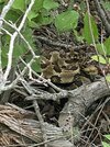
Did a 7.2 mile shakedown hike today on Shortoff Mountain in Linville Gorge. First time we have run into rattlesnakes in the Gorge - two timber rattlers sunning on the trail in less than a mile. They sure don’t like to have to move.
First one. Didn’t get a rattle count, but it looked like between 10 and 12.
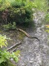
This one was longer and much bigger bodied. Had 10 rattles.
First one. Didn’t get a rattle count, but it looked like between 10 and 12.


This one was longer and much bigger bodied. Had 10 rattles.

Shame they're going to have to firebomb the gorge now.
My buddy hiked in the PA mountains last weekend and also posted video on Instagram of two meaty looking rattling nope-ropes hanging right out in the open. Meanwhile, I nearly screamed like a girl on my last hike after almost squishing a green snake under my left foot.
My buddy hiked in the PA mountains last weekend and also posted video on Instagram of two meaty looking rattling nope-ropes hanging right out in the open. Meanwhile, I nearly screamed like a girl on my last hike after almost squishing a green snake under my left foot.
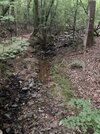
A few quick snaps from Anne Springs. What a disaster of a hike.
- Started raining but none made it through the canopy, making it a 90 degree hike in a total sauna.
- Tried jogging the first quarter mile or so in my carrier, and about died from calf cramps.
- Ended up catching the side of a broken root, rolled my ankle hard. Not sure if it was this or the jogging, but my left knee (the one that needs replaced) swelled up like a grapefruit by the time I got home.
- About shat my pants when the biggest coyote I ever saw crossed my path about 20 yards in front of me. Tall and fat, looked about like a big brown husky. Others were nearby, because they started making that god awful growling cat noise by the time I had made it back closer to the trailhead.
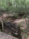
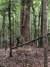
That tree is nothing impressive in the photo but was huge in person. It’s so much bigger than nearly every other tree in the area that it stuck out like a sore thumb. Didn’t manage to get any pics of the coyotes or Bambi this time. First two pics are taken off the bridge on the trail. It’s definitely getting well worn. Pre-COVID I would ride across it on my bike and it was rock solid. Now it feels like a springboard.


fieldgrade
waiting...
2A Bourbon Hound 2024
2A Bourbon Hound OG
Charter Life Member
Benefactor
Supporting Member
Multi-Factor Enabled
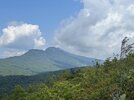
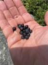
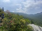
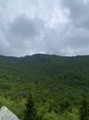
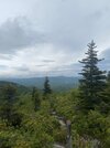
The clouds and the peaks just make me smile.Nothing serious but hiked Flat Rock Trail and Price Lake loop today. Not a lot of flowers but the blueberries were ripe. Just dodged a few rain showers. View attachment 649457View attachment 649458View attachment 649459
The clouds and the peaks just make me smile.
It's Grandfather Mtn.
cubrock
Swell guy
2A Bourbon Hound 2024
2A Bourbon Hound OG
Charter Life Member
Benefactor
Multi-Factor Enabled
Boy, am I behind on posting hike reports….
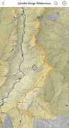
I turn 50 this year and am training for a birthday hike in Linville Gorge. To that end, I’m back to hiking in the Gorge weekly. Took a break for almost a month after this summer’s Montana trip (still have to post the report from that).
So…Wednesday I started at Wolfpit and hiked to the Table Rock parking area and back. That is between 14 and 15 miles round trip and it kicked my tail. I was surprised and humbled at how hard a time I had, as the bulk of that hike, the hardest parts, have been a mainstay in my Montana training and I was carrying only 15ish pounds this time (plus about 6 pounds gross in a kit bag) instead of my full Montana pack weight. Part of it may have been increased heat and humidity compared to when I hike this route in cooler seasons, but the high temperature was unseasonably cool in the mid 80s and I had cloud cover most of the hike.
I didn’t take a lot of pics, but what I did take are below. The air was very clear in the morning, so views were great until afternoon humidity kicked in. Total hike time was a smidge over 8 hours, which isn’t bad considering that includes three rest/lunch/snack stops at 20-30 minutes each and another 15ish minute stop to chat with two other hikers.
I’ve got a lot of work to do before my birthday hike.
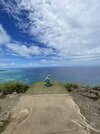
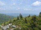
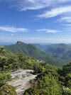
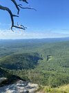
The obligatory shot of the view from Unbelievable Point. It is 1.3 miles into the hike after the grinding climb up the slopes of Shortoff Mountain. A welcome break and always a beautiful sight.
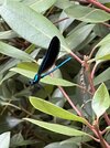
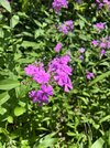
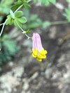
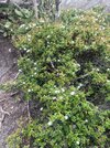
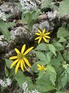
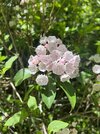
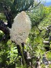
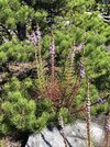
Never seen these blossoms before. The bumblebees loved them.
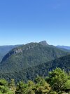
The Chimneys and Table Rock from about halfway across Shortoff. This time of year, the view is often very hazy. Not this morning! Humidity was almost fallish. That young pine ridge going up to The Chimneys in the right middle of the picture is where the trail is and it is a GRIND! One of the hardest parts of the hike, both up and down.
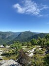
Nearly at the top of that pine ridge grind I mentioned above. I usually stop here for a break and lunch, as there is a great sitting rock. The top of the ridge is another tenth of a mile or so up, but the worst is behind me, until I have to go back down it.
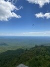
Afternoon haze is creeping in. Zoom in and you can see why they call them The Chimneys.
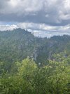
Halfway point at Table Rock parking area. There are bathrooms, but no water, unfortunately. Water points on this route are few and far between, and very inconvenient, requiring one to drop off the trail, often a couple hundred vertical feet or more. I just carry extra water and hope it is enough, though I have my filter with me just in case.
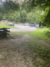
Headed back. View from The Chimneys looking back towards Shortoff.
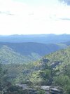
That dastardly pine ridge trail is in the middle of this pic. Partly obscured by trees closer to me. The lunch rock near the top is in the right middle of the pic.
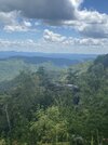
I turn 50 this year and am training for a birthday hike in Linville Gorge. To that end, I’m back to hiking in the Gorge weekly. Took a break for almost a month after this summer’s Montana trip (still have to post the report from that).
So…Wednesday I started at Wolfpit and hiked to the Table Rock parking area and back. That is between 14 and 15 miles round trip and it kicked my tail. I was surprised and humbled at how hard a time I had, as the bulk of that hike, the hardest parts, have been a mainstay in my Montana training and I was carrying only 15ish pounds this time (plus about 6 pounds gross in a kit bag) instead of my full Montana pack weight. Part of it may have been increased heat and humidity compared to when I hike this route in cooler seasons, but the high temperature was unseasonably cool in the mid 80s and I had cloud cover most of the hike.
I didn’t take a lot of pics, but what I did take are below. The air was very clear in the morning, so views were great until afternoon humidity kicked in. Total hike time was a smidge over 8 hours, which isn’t bad considering that includes three rest/lunch/snack stops at 20-30 minutes each and another 15ish minute stop to chat with two other hikers.
I’ve got a lot of work to do before my birthday hike.

The obligatory shot of the view from Unbelievable Point. It is 1.3 miles into the hike after the grinding climb up the slopes of Shortoff Mountain. A welcome break and always a beautiful sight.

Never seen these blossoms before. The bumblebees loved them.

The Chimneys and Table Rock from about halfway across Shortoff. This time of year, the view is often very hazy. Not this morning! Humidity was almost fallish. That young pine ridge going up to The Chimneys in the right middle of the picture is where the trail is and it is a GRIND! One of the hardest parts of the hike, both up and down.


Nearly at the top of that pine ridge grind I mentioned above. I usually stop here for a break and lunch, as there is a great sitting rock. The top of the ridge is another tenth of a mile or so up, but the worst is behind me, until I have to go back down it.

Afternoon haze is creeping in. Zoom in and you can see why they call them The Chimneys.

Halfway point at Table Rock parking area. There are bathrooms, but no water, unfortunately. Water points on this route are few and far between, and very inconvenient, requiring one to drop off the trail, often a couple hundred vertical feet or more. I just carry extra water and hope it is enough, though I have my filter with me just in case.

Headed back. View from The Chimneys looking back towards Shortoff.

That dastardly pine ridge trail is in the middle of this pic. Partly obscured by trees closer to me. The lunch rock near the top is in the right middle of the pic.

Last edited:
cubrock
Swell guy
2A Bourbon Hound 2024
2A Bourbon Hound OG
Charter Life Member
Benefactor
Multi-Factor Enabled
I forgot to mention - I got in a MESS of chiggers on that hike. There are several sections of the trail where you have to push through tall grass and brush. Don’t know which section I got them in, but I have dozens of bites from my thighs to my shoulders and a few on my ankles. Itchy!
I forgot to mention - I got in a MESS of chiggers on that hike. There are several sections of the trail where you have to push through tall grass and brush. Don’t know which section I got them in, but I have dozens of bites from my thighs to my shoulders and a few on my ankles. Itchy!
My wife got some of the worst bites I have ever seen up on the parkway last month. Thought she might need to go to the Dr it was so bad. She was absolutely covered from top of thighs to belly button.
cubrock
Swell guy
2A Bourbon Hound 2024
2A Bourbon Hound OG
Charter Life Member
Benefactor
Multi-Factor Enabled
My wife got some of the worst bites I have ever seen up on the parkway last month. Thought she might need to go to the Dr it was so bad. She was absolutely covered from top of thighs to belly button.
I stopped counting this morning at 70, and that was all above the waist. Thankfully, the itching has been limited to one area or another at a time. It is like my body is limiting the histamine response so that only my side itches, or my stomach, or my arm. Has made it bearable.
fieldgrade
waiting...
2A Bourbon Hound 2024
2A Bourbon Hound OG
Charter Life Member
Benefactor
Supporting Member
Multi-Factor Enabled
This brings back memories of hiking and riding dirt bikes around the old Mitchell toll road from Black Mountain to the Parkway fifty years ago. I was up there every summer for a few weeks as a kid till I went to school there at Montreat.
cubrock
Swell guy
2A Bourbon Hound 2024
2A Bourbon Hound OG
Charter Life Member
Benefactor
Multi-Factor Enabled
Did 14 miles in Linville Gorge yesterday. Same route as last week, Wolf Pit to Table Rock parking area and back. Tough hike, but I did better than last week and didn’t run into an army of chiggers, evidently.
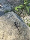
Saw this little guy about 3.5 miles in. This year’s fence lizard. He was only about 2” long. He remained perfectly still the whole time I stepped around him trying to get the right picture. Saw lots of toads on the trail, both small and large.
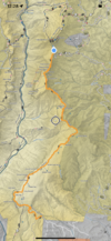
It is funny how one’s perspective changes. There was a time when I wouldn’t dream of hiking 14 miles at a time, much less over terrain as rugged as that found in Linville Gorge. Now 14 miles in the Gorge is 8.5 hours of training for 22 miles in the Gorge later on. Lol.


