You are using an out of date browser. It may not display this or other websites correctly.
You should upgrade or use an alternative browser.
You should upgrade or use an alternative browser.
Post your recent hiking pics
- Thread starter chiefjason
- Start date
- Replies 538
- Views 13,046
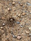
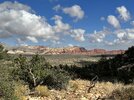
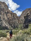
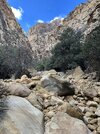
I 'bout wore out the "Like" button!Day 4: back to Red Rock, Ice Box Canyon.
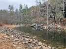
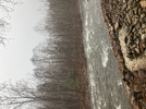
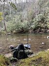
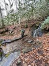
Holy crap! So much rain it went sideways!!!Linville River yesterday and then this morning after rain last night:
View attachment 710377
View attachment 710378
cubrock
Swell guy
2A Bourbon Hound 2024
2A Bourbon Hound OG
Charter Life Member
Benefactor
Multi-Factor Enabled
Linville River yesterday and then this morning after rain last night:
View attachment 710377
View attachment 710378
Is that near (just downstream of) the MST crossing?
Yes.Is that near (just downstream of) the MST crossing?
Gonna just post these here. It started off as a squirrel hunt. But they didn’t cooperate. It ended up being a 4.5 mile cross country scouting trip. Found some really cool spots I’ll try to get back too.
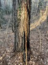
My trusty squirrel shooting stick. Had this for years. Split the Y off today and going try to fix it.
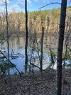
Frozen beaver pond.
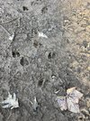
Deer tracks
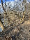
Flooded river bank
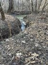
Creek cut through the flood zone.
Coyote
Raccoon
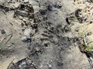
Bobcat
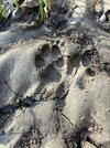
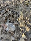
Box turtle shell
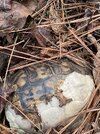
Turkey
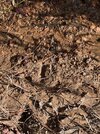
My trusty squirrel shooting stick. Had this for years. Split the Y off today and going try to fix it.

Frozen beaver pond.

Deer tracks

Flooded river bank

Creek cut through the flood zone.

Coyote

Raccoon

Bobcat

Box turtle shell

Turkey


Last edited:
I ended the year with 57 paddle excursions from 05Jan-22Dec for a grand total of 532 miles paddled. Almost all were afternoon, sunset, & twilight paddles including a waxing gibbous and full moon paddle each month.
I easily took 1k of pictures and enjoyed every minute spent on the water!! I don't know if I'll get out as much in 2024, but every time I do I will be enjoying myself to the maximum!! Probably my two favorite photos of the year:

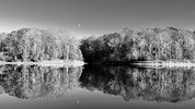
I easily took 1k of pictures and enjoyed every minute spent on the water!! I don't know if I'll get out as much in 2024, but every time I do I will be enjoying myself to the maximum!! Probably my two favorite photos of the year:


Last edited:
Thanks, I started kayaking due to a really bad plantar fasciitis issue in '22. I often joke that kayaking is the equivalent of "hiking on water" with all the stunning views and amount of wildlife I see each time.Hiking with your arms! Nice work. And thanks for the great pics.
Johnny9Toes
New Member
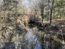
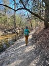
Did a quick 5 mile day hike Saturday at Raven Rock State Park. First time there. It was nice to get out town. The trails are well maintained and marked, with gradual elevation changes. Not a lot of scenic ops, but sections by the Cape Fear and Campbell creek were really nice. We try to find time for Lunch and Hammocks when we do these day outings.
There was a lot of trail traffic though. I guess everyone had the same idea.
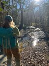
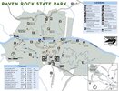
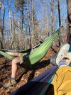
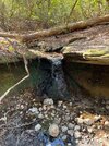
There was a lot of trail traffic though. I guess everyone had the same idea.


Took Chaser to Bakers Mtn last week.
Hiked into Daffodil Flats in Linville Gorge today to visit the early flowers. I'll get some more vids up soon. I have vids of the entire hike and a bunch of shorts I'm working on. This is the first one. Caught a great sunset from Pinnacle Rock. And White Oak Stand trail is as insane as I remember. lol
This might be the first rescue of the season. Heading into daffodil flats via pinch in is no joke.
“The Burke County Rescue Squad says a hiker developed a medical condition along the Pinch-In Trail on the west side of the Linville Gorge”
:quality(70)/cloudfront-us-east-1.images.arcpublishing.com/cmg/5DC4PV3W75BMVMCIVSSLSZEEAE.png)
 www.wsoctv.com
“The Burke County Rescue Squad says a hiker developed a medical condition along the Pinch-In Trail on the west side of the Linville Gorge”
:quality(70)/cloudfront-us-east-1.images.arcpublishing.com/cmg/5DC4PV3W75BMVMCIVSSLSZEEAE.png)
Dozens help rescue hiker in Linville Gorge
The Burke County Rescue Squad says a hiker developed a medical condition along the Pinch-In Trail on the west side of the Linville Gorge.
cubrock
Swell guy
2A Bourbon Hound 2024
2A Bourbon Hound OG
Charter Life Member
Benefactor
Multi-Factor Enabled
This might be the first rescue of the season. Heading into daffodil flats via pinch in is no joke.
“The Burke County Rescue Squad says a hiker developed a medical condition along the Pinch-In Trail on the west side of the Linville Gorge”
:quality(70)/cloudfront-us-east-1.images.arcpublishing.com/cmg/5DC4PV3W75BMVMCIVSSLSZEEAE.png)
Dozens help rescue hiker in Linville Gorge
The Burke County Rescue Squad says a hiker developed a medical condition along the Pinch-In Trail on the west side of the Linville Gorge.www.wsoctv.com
It is much longer, but hiking to Daffodil Flats from Wolf Pit avoids the huge elevation changes involved in hiking down from the western rim of the Gorge. You have to wade the Linville River once going and once coming back, but that isn't that big a deal with decent shoes and socks.
cubrock
Swell guy
2A Bourbon Hound 2024
2A Bourbon Hound OG
Charter Life Member
Benefactor
Multi-Factor Enabled
Hiked in Linville Gorge today - the annual pilgrimage to Daffodil Flats. Started at Wolfpit parking area, took the Faulkner Flats/Fonta Flora connector down to the MST and across the Linville River, over to Lead Mine and to the flats. Temps in the 60s and cloudy for most of the hike, until I got rained on the last couple hours. The last 20 minutes or so, it POURED! So glad it was as warm as it was.
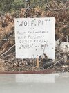
Saw this sign as I drove up Wolfpit Rd. Not sure exactly what it means. Are they totally shutting down Wolfpit Rd to public traffic? They can’t shut the parking area down as it is on NFS land, but maybe the landowners there are going to try to keep us from driving on the private part of the road to get to it. I’ll have to call the ranger station to ask about it.
@chiefjason, heard anything about this?
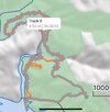
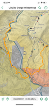
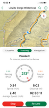
I didn’t take many pics this trip. Was trying (unsuccessfully) to beat the rain. Here is the route:
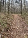
River was low and the crossing was uneventful, if cold. Feet and legs warmed right up after I got out of the water. Not far from the crossing, when you hit the dirt road that comes up from little Linville, there are some scattered daffodils. I have often wondered if they came from bulbs that washed downstream from the flats. Anywho, when they are blooming, you can bet the ones at the flats are blooming, too. Nice way to check without having to hike the 6 miles in from Wolfpit.
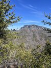
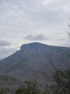
View of Shortoff Mountain from an unnamed hill along the MST:
Made it to Daffodil Flats in 2.5 hours. Not bad for it being 6 miles with a long river crossing and slippery, wet terrain.
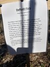
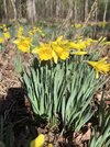
Daffodil Flats:
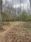
I didn’t bring enough tortillas or mustard. I was trying the long term packaged chicken breast and tuna from Walmart. Chicken breast fit in one tortilla. Tuna needed at least two, but I had only one left. It was like a fat, messy tuna soft taco.

Spent about half an hour having lunch at the flats and another ten minutes filtering water not far along the hike back. This was my first Gorge hike since September and it was a bit humbling. I’ve been working out/running all along, but there is nothing like Gorge miles to test endurance. I had to stop to catch my breath several times on some of the steeper climbs and again along the long slog back up Faulkner Flats the last mile and change. Faulkner Flats trail isn’t THAT steep for the Gorge, but it goes on and on after you’ve already put some serious miles in.
I’ll be hiking regularly again after the 10K in April. Till then, I’ll try to work some more in as I can.
Saw this sign as I drove up Wolfpit Rd. Not sure exactly what it means. Are they totally shutting down Wolfpit Rd to public traffic? They can’t shut the parking area down as it is on NFS land, but maybe the landowners there are going to try to keep us from driving on the private part of the road to get to it. I’ll have to call the ranger station to ask about it.
@chiefjason, heard anything about this?

I didn’t take many pics this trip. Was trying (unsuccessfully) to beat the rain. Here is the route:

River was low and the crossing was uneventful, if cold. Feet and legs warmed right up after I got out of the water. Not far from the crossing, when you hit the dirt road that comes up from little Linville, there are some scattered daffodils. I have often wondered if they came from bulbs that washed downstream from the flats. Anywho, when they are blooming, you can bet the ones at the flats are blooming, too. Nice way to check without having to hike the 6 miles in from Wolfpit.

View of Shortoff Mountain from an unnamed hill along the MST:

Made it to Daffodil Flats in 2.5 hours. Not bad for it being 6 miles with a long river crossing and slippery, wet terrain.

Daffodil Flats:

I didn’t bring enough tortillas or mustard. I was trying the long term packaged chicken breast and tuna from Walmart. Chicken breast fit in one tortilla. Tuna needed at least two, but I had only one left. It was like a fat, messy tuna soft taco.

Spent about half an hour having lunch at the flats and another ten minutes filtering water not far along the hike back. This was my first Gorge hike since September and it was a bit humbling. I’ve been working out/running all along, but there is nothing like Gorge miles to test endurance. I had to stop to catch my breath several times on some of the steeper climbs and again along the long slog back up Faulkner Flats the last mile and change. Faulkner Flats trail isn’t THAT steep for the Gorge, but it goes on and on after you’ve already put some serious miles in.
I’ll be hiking regularly again after the 10K in April. Till then, I’ll try to work some more in as I can.
I knew the road was private but have not heard anything about the road being closed. Then again, the public can ruin anything given enough time, That or there will be houses going up in there.
cubrock
Swell guy
2A Bourbon Hound 2024
2A Bourbon Hound OG
Charter Life Member
Benefactor
Multi-Factor Enabled
I knew the road was private but have not heard anything about the road being closed. Then again, the public can ruin anything given enough time, That or there will be houses going up in there.
There are definitely more houses being built than when I was up here in the fall.
I'll ask about that sign-I "know" some people...lol.
@cubrock you ain't wrong about Gorge trails being rough. Back in the late 80s me and my best friend were hiking a lot in there. My best friend is skinny and can eat up the miles compared to me. We took another acquaintance who was in great shape also-had just lettered in wrestling at EBHS a couple years before. We broke camp on Spence Ridge and I got a lead when one of them had to turn around and go back for something. I pushed hard KNOWING these two would catch me going up "Little Table Rock" trail, which gets pretty steep. I finally had to take a "sit down" breather, and they caught up to me. I KNEW I was wasted, but figured these two would just be strolling. NO! They came up sucking air and panting. Even our younger athletic friend was shocked, and and said he couldn't believe how hard that experience was as he was not used to gasping for air like that. From then on we basically always said "The only way to prepare for strenuous hiking is by-strenuous hiking!"
@cubrock you ain't wrong about Gorge trails being rough. Back in the late 80s me and my best friend were hiking a lot in there. My best friend is skinny and can eat up the miles compared to me. We took another acquaintance who was in great shape also-had just lettered in wrestling at EBHS a couple years before. We broke camp on Spence Ridge and I got a lead when one of them had to turn around and go back for something. I pushed hard KNOWING these two would catch me going up "Little Table Rock" trail, which gets pretty steep. I finally had to take a "sit down" breather, and they caught up to me. I KNEW I was wasted, but figured these two would just be strolling. NO! They came up sucking air and panting. Even our younger athletic friend was shocked, and and said he couldn't believe how hard that experience was as he was not used to gasping for air like that. From then on we basically always said "The only way to prepare for strenuous hiking is by-strenuous hiking!"
Last edited:
I'll ask about that sign-I "know" some people...lol.
@cubrock you ain't wrong about Gorge trails being rough. Back in the late 80s me and my best friend were hiking a lot in there. My best friend is skinny and can eat up the miles compared to me. We took another acquaintance who was in great shape also-had just lettered in wrestling at EBHS a couple years before. We broke camp on Spence Ridge and I got a lead when one of them had to turn around and go back for something. I pushed hard KNOWING these two would catch me going up "Little Table Rock" trail, which gets pretty steep. I finally had to take a "sit down" breather, and they caught up to me. I KNEW I was wasted, but figured these two would just be strolling. NO! They came up sucking air and panting. Even our younger athletic friend was shocked, and and said he couldn't believe how hard that experience was as he was not used to gasping for air like that. From then on we basically always said "The only way to prepare for strenuous hiking is by-strenuous hiking!"
Rhythmic breathing, something I've known about since I was introduced to it in college, but only recently feel like I get it. Nose surgery and breaking my mouth breathing habit were big parts of that too. I refuse to let my breathing and pulse get out of control anymore. I kept my pulse between 140 and 160 coming up Unnamed trail. And I never felt like I had to stop or got out of breath. I would slow my pace and increase my breathing to compensate. It makes you less tired overall by doing it that way. Letting it all get out of control until you have to stop is exhausting. There is not a hard pattern but a good place to start on level ground is breath in for 2-3 steps and breath out for 2-3 steps. When I go uphill I no longer breath faster, I breath DEEPER and actually slower.
I need to find a good resource and post it here. Lots of small blurbs of info but most is not really getting to the point I want to make. I know WCU did research on it a few years back and put the science to why it works.
Last edited:
cubrock
Swell guy
2A Bourbon Hound 2024
2A Bourbon Hound OG
Charter Life Member
Benefactor
Multi-Factor Enabled
Just called the Grandfather District Ranger Office and the person I talked to hadn't heard anything about the Wolf Pit closure sign. She is going to have someone up the food chain call me back.
I asked the Burke Sheriff's Office Community Officer for Lake James and he said he has seen he sign(s) but *believes* its just locals frustrated with littering and doesn't *think* there is any truth to it...at least that they can or will close the road to the trailhead.
cubrock
Swell guy
2A Bourbon Hound 2024
2A Bourbon Hound OG
Charter Life Member
Benefactor
Multi-Factor Enabled
I asked the Burke Sheriff's Office Community Officer for Lake James and he said he has seen he sign(s) but *believes* its just locals frustrated with littering and doesn't *think* there is any truth to it...at least that they can or will close the road to the trailhead.
I have a lot of sympathy for those landowners. I am sure they put up with a lot of unnecessary crap.
Tim
Checked Out
Staff member
2A Bourbon Hound 2024
2A Bourbon Hound OG
Charter Life Member
Benefactor
Vendor
Multi-Factor Enabled
novemberdelta
New Member
cubrock
Swell guy
2A Bourbon Hound 2024
2A Bourbon Hound OG
Charter Life Member
Benefactor
Multi-Factor Enabled
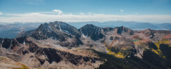
Just moved to NC from CO, but this was our last hike before we moved last fall. Excited to get back on the trail this spring in NC (and have some air to breathe while doing it).
Mt. Huron summit:
View attachment 750347
I’ve hiked in Colorado once and it was a short day hike. All we had time for. I’d like to do some backpacking out there, maybe even tackle a 14k peak when I’m in good enough shape, just to say I’ve done it.
This is from yesterday, I don't often do videos while kayaking however I felt this moment was worth capturing for posterity. I typically paddle up to the Northernmost accessible section of the Beaverdam Rec area (Falls Lake) and just float around enjoying the tranquility and observing Nature. There is an abundance of wildlife in this area and and a significant lack of people due to it being ~3miles away from the launch!! I often see bald eagles, heron, egrets and osprey. Last year the beavers were often out later in the evening, but they are quite skittish and I rarely got close enough for a decent photo or video. 
03March2024
As I was writing this I recalled that last Spring I captured another video of the actual beaverdam that was destroyed or removed in mid July 2023
29Apr2023
03March2024
As I was writing this I recalled that last Spring I captured another video of the actual beaverdam that was destroyed or removed in mid July 2023
29Apr2023
cubrock
Swell guy
2A Bourbon Hound 2024
2A Bourbon Hound OG
Charter Life Member
Benefactor
Multi-Factor Enabled
This is from yesterday, I don't often do videos while kayaking however I felt this moment was worth capturing for posterity. I typically paddle up to the Northernmost accessible section of the Beaverdam Rec area (Falls Lake) and just float around enjoying the tranquility and observing Nature. There is an abundance of wildlife in this area and and a significant lack of people due to it being ~3miles away from the launch!! I often see bald eagles, heron, egrets and osprey. Last year the beavers were often out later in the evening, but they are quite skittish and I rarely got close enough for a decent photo or video.
03March2024
As I was writing this I recalled that last Spring I captured another video of the actual beaverdam that was destroyed or removed in mid July 2023
29Apr2023
Spring Peepers haven't come out here yet.
cubrock
Swell guy
2A Bourbon Hound 2024
2A Bourbon Hound OG
Charter Life Member
Benefactor
Multi-Factor Enabled
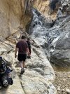
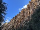
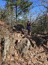
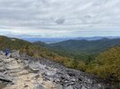
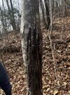
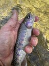
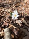
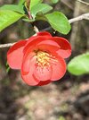
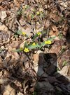
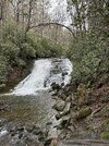
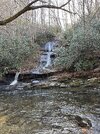
The trail wasn’t much for scenery. But a few wildflowers starting to show and caught a couple fish.
View attachment 756832View attachment 756833View attachment 756834View attachment 756835
What is the red flower?
I've posted a few of these in another thread already, but they deserve a mention here.
On a fish/camp trip in late February, we did a short hike on Bear Island in Hammock Beach State Park.
It was a good morning for a hike.
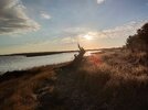
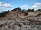
The dunes varied from low & scrubby...
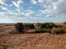
to rolling and somewhat steep.
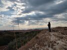
A good place for coffee & contemplation.
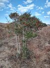
Yaupon Holly, aka "Southern Tea." Interesting story: https://www.starnewsonline.com/stor...-yaupon-is-original-southern-tea/22845476007/
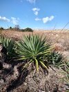
Yucca, aka "Spanish Dagger." The name is self-explanatory.
We wound up down on the beach.
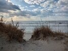
Quite the change of scenery over a short distance.

Later in the day, we did some "hiking" elsewhere, too.
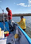
That was a little more productive!
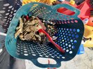
On a fish/camp trip in late February, we did a short hike on Bear Island in Hammock Beach State Park.
It was a good morning for a hike.

The dunes varied from low & scrubby...

to rolling and somewhat steep.

A good place for coffee & contemplation.

Yaupon Holly, aka "Southern Tea." Interesting story: https://www.starnewsonline.com/stor...-yaupon-is-original-southern-tea/22845476007/

Yucca, aka "Spanish Dagger." The name is self-explanatory.

We wound up down on the beach.

Quite the change of scenery over a short distance.

Later in the day, we did some "hiking" elsewhere, too.

That was a little more productive!

Last edited:
What is the red flower?
Flowering Quince from my phone look up. Looks like it's a Japanese Shrub.


